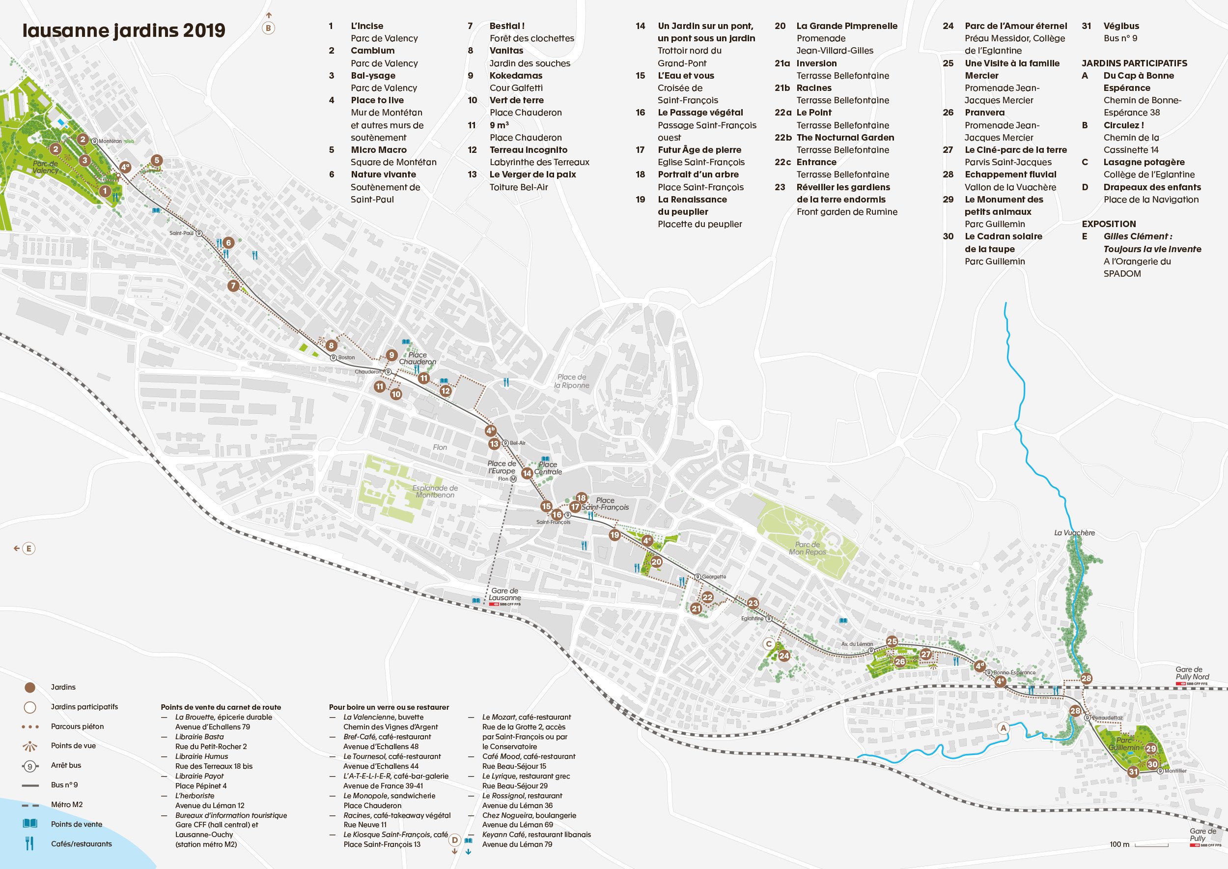
Several major undertakings are planned for 2019, including the Axes Forts mobility project. Burying the LEB tracks, a new Lausanne-Villars-Ste-Croix tram, high quality service busses (BHNS), the M3 underground, the closing of the Grand-Pont to car traffic: All these projects will radically change the people’s perception of the city and its uses. LJ2019 falls within this context, as a prefiguration of the upcoming changes.
The route extends from west to east along the current No. 9 bus line. It connects the town of Prilly on one side to Pully on the other on one of the historical routes of Lausanne’s first tramways. This journey through the city, four kilometres from end to end, against the natural movement of the slope, was only made possible thanks to major urban planning projects in the second half of the 19th century, including the construction of the Grand-Pont.

The special feature of this axis is that it follows a ridge line. Despite the route’s low gradient, it offers a series of panoramic viewpoints with spectacular views of the landscape and the lake.
From Valency Park to Guillemin Park, the sites are scattered along the route. Each speaks of its soil and qualities – qualities that change according to the neighbourhoods and the various urban characteristics, and the vegetation changes with them. From open ground to open ground, via the city centre’s off-ground cultivation.